Saarbrücken:Environmental Impact and Natura 2000 Study for the upgrading of the runway system of Saarbruecken International Airport (feasibility study)
Disciplines
-
 Airports
-
 Environment & Sustainability
Companies
Dorsch International Consultants
Client
Flughafen Saarbruecken Betriebsgesellschaft mbH
Duration
From 2007 to 2008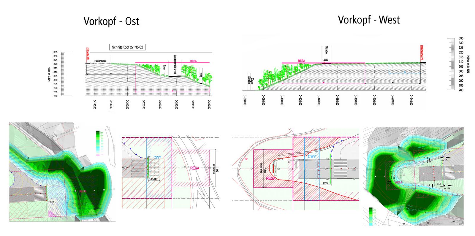
Project Activities
- Environmental study and evaluation for seven alternative runway configurations
- Natura 2000 assessment study for seven alternative runway configurations
- Input in the technical design of the feasibility study
- Digital land use and habitat inventory
- Workshops and discussions with local committees (Committee for noise prevention and reduction)
Contact
Dorsch International Consultants GmbH
München (Headquarters)
80687 München
Germany
Phone: +49 89 5797-0
Fax: +49 89 5797-800
E-Mail: info@dorsch.de
Description
The state government of Saarland and the Saarbruecken airport authority are planning to enhance the runway system and adapt the safety areas to ICAO-regulations.
For the feasibility study seven alternatives of runway configurations have been designed.
In parallel the environmental aspects have been analysed by DC Water and Environment in a combined environmental and Natura 2000 assessment study, evaluating and comparing the alternatives from the environmental point of view.
The results of the study have been implemented in the technical design.
The airport is situated in a unique environment with hills, forests and deep valleys.
12 areas of nature protection and Natura 2000 sanctuaries are surrounding the airport site.
Besides, several ecologically sensitive areas consisting of important habitats had to be taken into consideration.
Therefore an area of 12 km in diameter from each threshold has been investigated on Natura 2000 aspects and an area of 2,5 km surrounding the runway alternatives has been investigated in more detail with several field studies.
Based on these field studies a land use and habitats map was created and digitalised into a GIS project. This was used as a basis for the environmental impact assessment.